Territographie

Collection chapelles rurales - Position d'un édifice
Ceillac (05) - chapelle Saint-Antoine
--> dossiersinventaire.regionpaca.fr
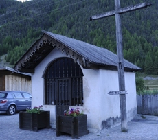
vue en 2010
© UMR CNRS/MCC 3495 MAP
--> dossiersinventaire.regionpaca.fr
vue en 2010
© UMR CNRS/MCC 3495 MAP