Territographie

Collection chapelles rurales - Position d'un édifice
La Bastide-des-Jourdans (84) - Chapelle Notre Dame de Consolation
--> bastidedesjourdans.com --> laforest.mireille.free.fr
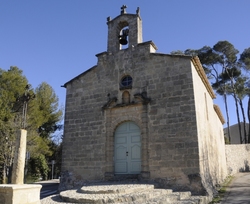
vue en 2014
© UMR CNRS/MCC 3495 MAP
--> bastidedesjourdans.com --> laforest.mireille.free.fr
vue en 2014
© UMR CNRS/MCC 3495 MAP